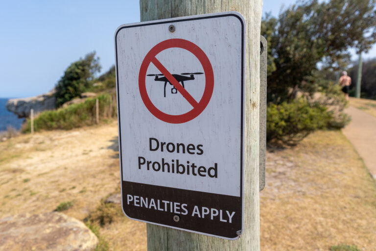
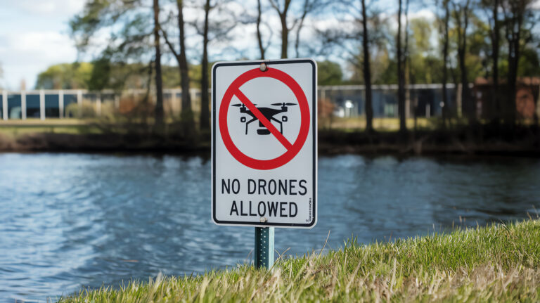
Blog

AutoPylot Ends the Hourly Insurance Era with $15 Full-Day Coverage
| |

AutoPylot Ends the Hourly Insurance Era with $15 Full-Day Coverage

Starting at Just $15 a day, FAA-approved B4UFLY and LAANC Provider AutoPylot Now Offers Full-Day Coverage for the same price as an Hourly Insurer’s. AutoPylot, one of the fastest-growing drone flight platforms in the U.S., has launched daily drone insurance policies directly within its mobile app — giving drone pilots longer, more flexible coverage at…

Equipment Manager: An Easier Way to Track Drones!

Equipment Manager: An Easier Way to Track Drones!

Introducing Equipment Management in AutoPylot: Take Control of Your Drone Fleet At AutoPylot, we’re always looking for ways to simplify and streamline drone operations—from flight planning to airspace access, to now, fleet and equipment management. Today, we’re excited to announce our newest feature: Equipment Management, built to give drone pilots and teams complete control over their hardware…

Easily Share and Export Your Drone Missions with AutoPylot+
| |

Easily Share and Export Your Drone Missions with AutoPylot+

New Feature Drop: Share and Export Your Missions with Ease 🚀 We’re excited to introduce one of our most requested tools: Mission Share and Export — now live in AutoPylot! Whether you’re documenting flights for your team, clients, or compliance, our new export tools make package and share your flight data effortless. 📄 PDF Mission Share From your…

Sports Stadium TFRs: Understanding Stadium Rules and Super Bowl Airspace Restrictions
| |

Sports Stadium TFRs: Understanding Stadium Rules and Super Bowl Airspace Restrictions

Stadium TFRs can be tricky to understand and locate, making them a potential pitfall for drone pilots. As drone technology grows in popularity, operators must navigate these complex airspace restrictions—especially near sports stadiums, where TFRs are frequently in place but not always easy to spot in standard flight planning tools. Stadium TFRs: What You Need to…

The Growing Requirement for Drone Insurance in State Parks, Counties, and Universities
|

The Growing Requirement for Drone Insurance in State Parks, Counties, and Universities

The Growing Requirement for Drone Insurance in State Parks, Counties, and Universities As drone popularity soars among hobbyists and professionals alike, the need for clear regulatory guidelines has become increasingly important. Across the United States, various state parks, counties, and universities have introduced specific rules for using drones on their properties. In many cases, these…

DJI NEO: The Ultimate Pocket-Sized Drone for Everyday Moments
|

DJI NEO: The Ultimate Pocket-Sized Drone for Everyday Moments

The DJI NEO redefines the mini-drone market by offering a compact, ultra-lightweight design that packs powerful features into just 135g. Perfect for indoor and outdoor use, it boasts a palm takeoff and landing system, voice control, and a range of intelligent flight modes like QuickShots for effortless video capture. Its 12MP camera, equipped with a…

Avoid Airspace Surprises: 5 Safety Perks of AutoPylot’s Scheduled TFR Update

Avoid Airspace Surprises: 5 Safety Perks of AutoPylot’s Scheduled TFR Update

At AutoPylot, we’re dedicated to providing drone pilots with the tools they need to fly safely and efficiently. Our latest enhancement expands the Temporary Flight Restriction (TFR) feature, notifying you if your flight overlaps with a scheduled TFR. This proactive approach to flight planning offers significant safety benefits. Here are five reasons why knowing about upcoming TFRs…

Introducing Windy Map Layers To AutoPylot+

Introducing Windy Map Layers To AutoPylot+

Table of Contents 1. Introduction to AutoPylot+ Weather Features At AutoPylot, we’re committed to providing the best tools for drone operators to plan and execute their missions confidently. One key element of successful drone flights is understanding the weather conditions, which is why we’ve continually enhanced the weather features in AutoPylot+. Today, we’re excited to…

Drone Photography: 5 Easy Ways to Dramatically Improve Your Photos

Drone Photography: 5 Easy Ways to Dramatically Improve Your Photos

Drone Photography: 5 Easy Ways to Dramatically Improve Your Photos Drones have revolutionized the way we capture stunning aerial imagery. However, achieving professional-quality drone photos requires more than just lifting off and snapping away. Here are five easy tips to elevate your drone photography game, focusing on composition, lighting, camera settings, and post-processing. Master Composition:…

Understanding DJI GEO Zones vs. FAA LAANC Airspace Approvals
|

Understanding DJI GEO Zones vs. FAA LAANC Airspace Approvals

In the rapidly evolving world of drone technology, understanding airspace regulations is crucial for hobbyists and professional drone pilots. Two terms often encountered are DJI GEO Zones and FAA LAANC airspace approvals. While both aim to ensure safe drone operations, they operate quite differently. Here’s a breakdown of their differences and what drone pilots need…