NO.1 rated flight planning app for drone pilots
Search & discover airspace, request LAANC, track weather, and manage all your flights
4.8
2,000+ Reviews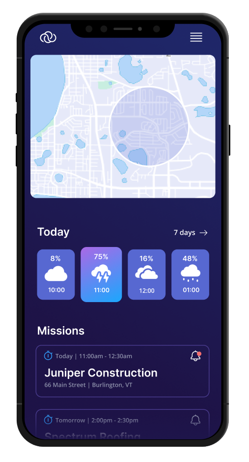


Why AutoPylot
The drone industry’s first fully integrated mission planning solution.
Combining essential mission planning elements such as airspace, weather, and mission management into one easy-to-use application, AutoPylot helps drone pilots more efficiently and safely prepare for flights.
Check B4UFLY, Get LAANC
Weather insights and forecast
Liability and Hull coverage
Features
Fully integrated mission planning solution.
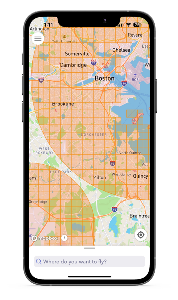
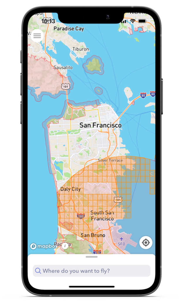
B4UFLY Flight Indicator
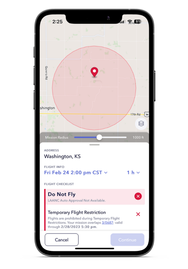
Quickly find your desired flight location by typing it in or tapping the map to drop a pin. AutoPylot’s B4UFLY flight status indicators instantly tell pilots whether it is safe to fly, if they need approval, or if the airspace is restricted.
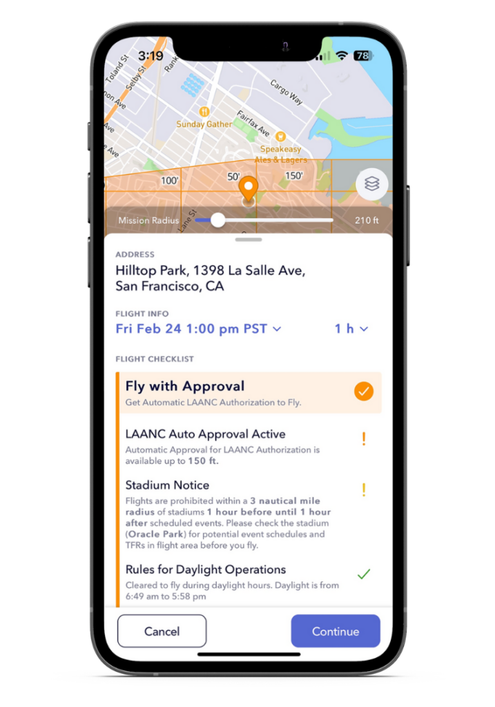
Flight Checklist
AutoPylot’s flight checklist organizes all airspace advisories that apply to the mission location. To ensure flight safety, the app lets pilots know which specific rules to look out for if they are good to fly, alerts them if they need approval, and tells them why the area may be restricted.
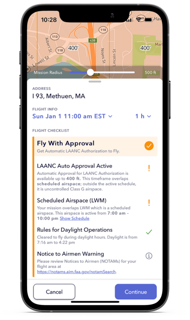
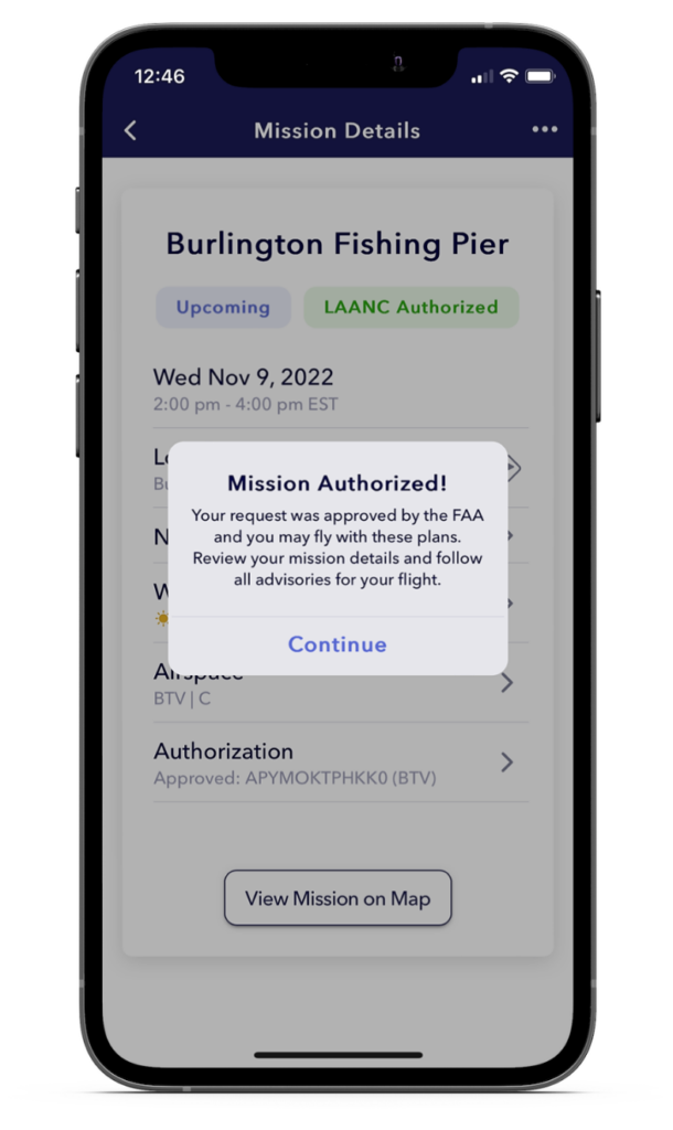
Get LAANC
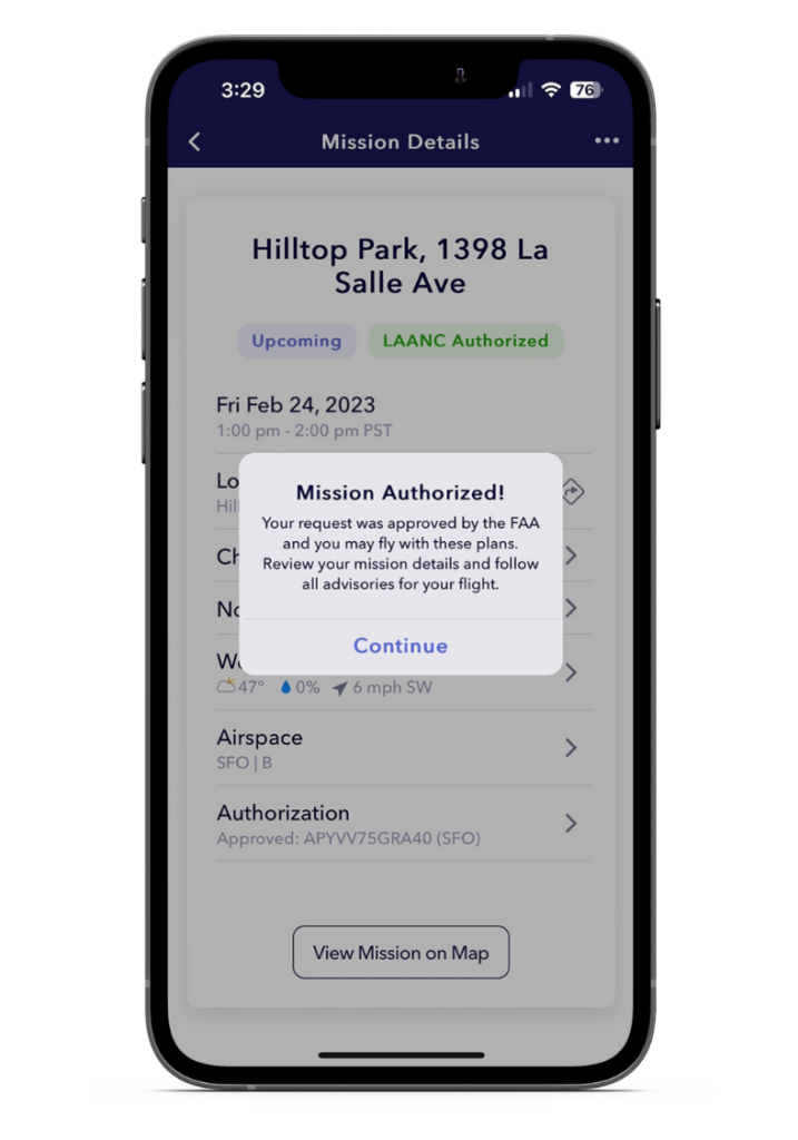
AutoPylot is a certified uncrewed service supplier of low-altitude authorizations and notification capability (LAANC). The app will indicate when planned flight areas are in LAANC-enabled airspace, allowing pilots to request authorization to fly in it.

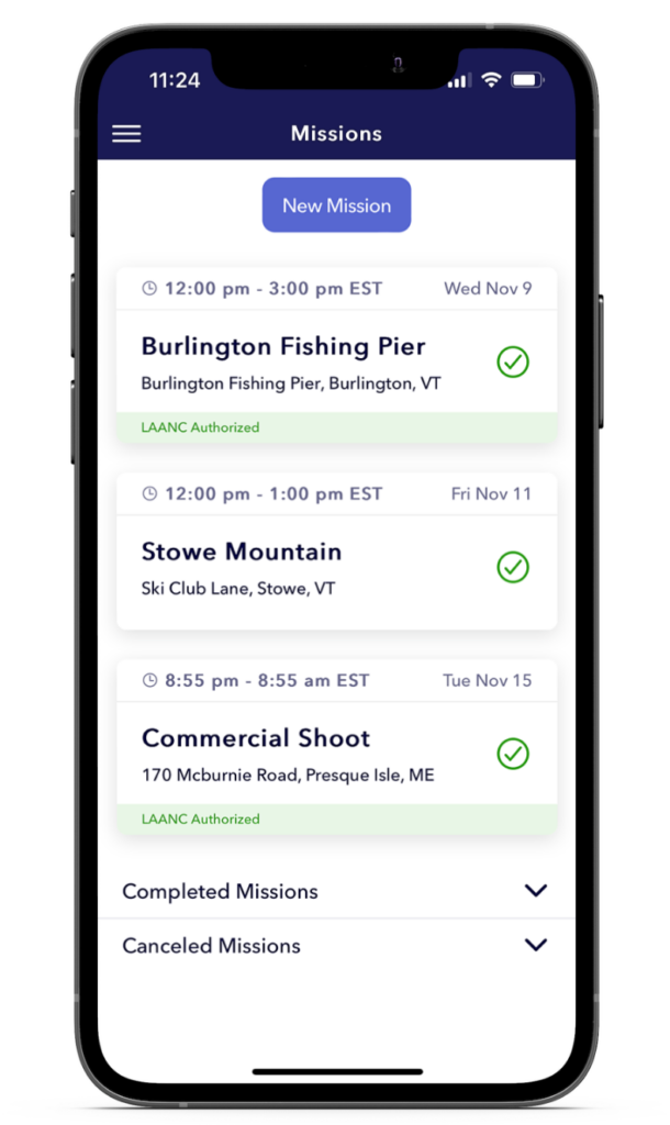
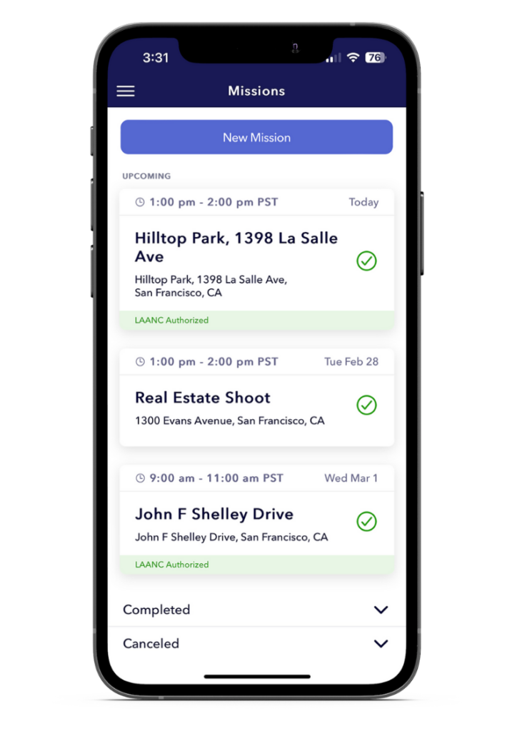
Track And Fly
AutoPylot makes it easy for pilots to track flights with their mission list. Pilots can see all of their upcoming, completed, and canceled flights in one easy-to-find place. If any advisories change, preventing a safe flight, our app instantly alerts the pilot.
Less Time Planning, More Time Flying
Simplified mission management.
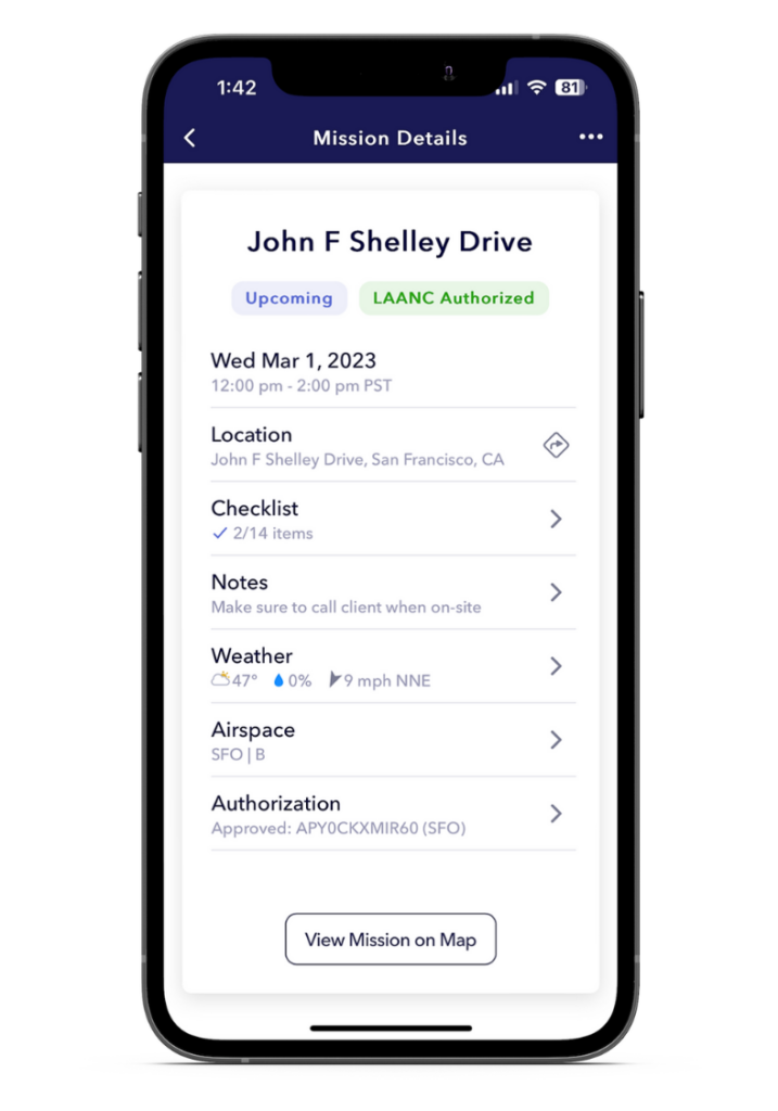
Access your mission-critical information in one easy-to-find location.
Plan your flight with precision.
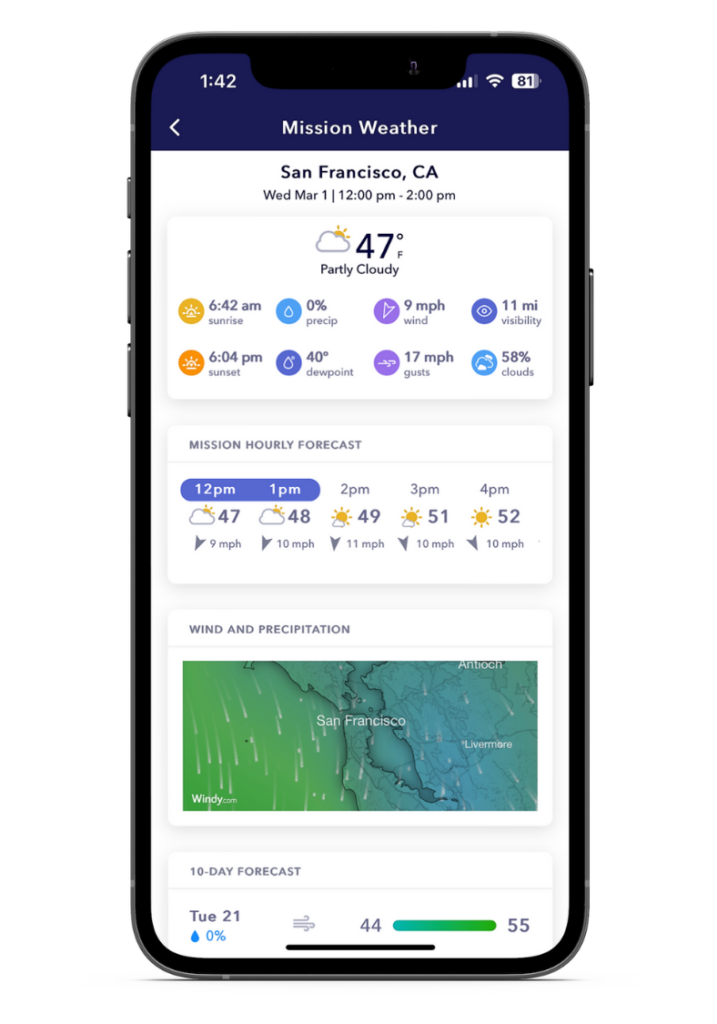
Mission-specific weather helps pilots plan more safely and efficiently by providing them;
Organize your flights your way.
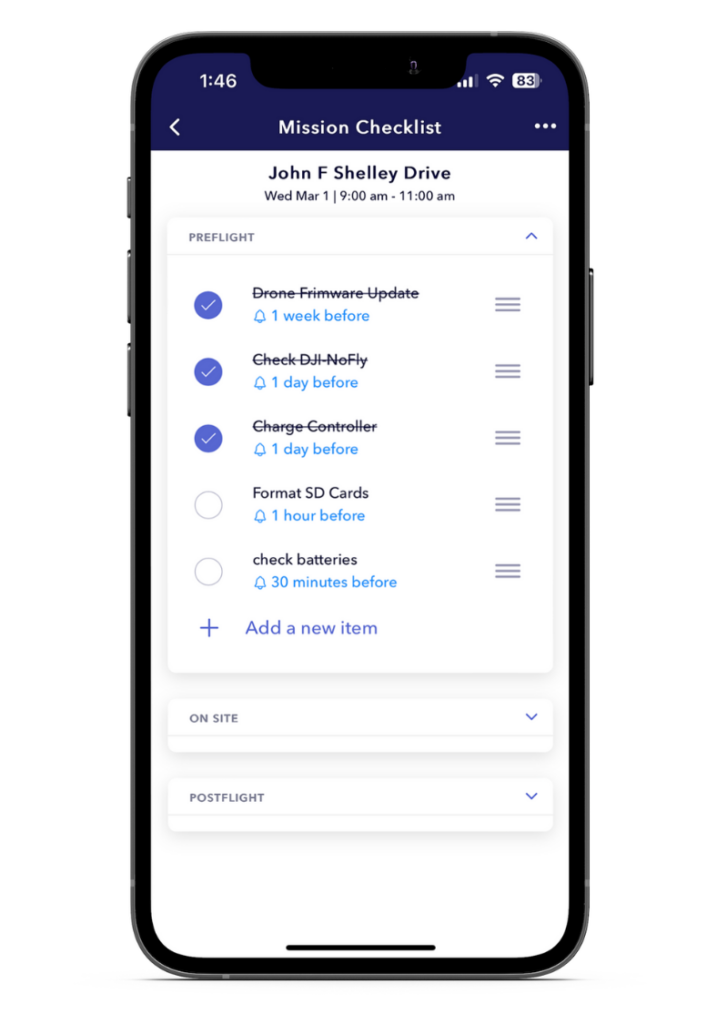
Plan, organize, and get notified on any task for any flight with AutoPylot’s mission checklists.
Streamline your schedule.
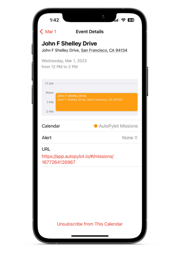
See all of your missions on your calendar by integrating AutoPylot’s calendar connect.
Operational awareness on demand.
AutoPylot helps drone pilots identify all the risks before their flight by displaying
Get the answers.
Still curious about AutoPylot and LAANC? See FAQs below.
AutoPylot is an FAA-approved pre-flight planning software enabling drone pilots to legally know where it is safe to fly their drone(s).
AutoPylot offers both B4UFLY and LAANC to recreational, commercial, and government drone operators for free.
AutoPylot provides B4UFLY services and near real-time airspace authorizations to commercial pilots (Part-107) and recreational flyers. When requesting airspace access, pilots must enter their Remote Pilot Certificate number or TRUST Certificate Authentication Token number. This will be displayed in the menu header.
DJI Fly Zones are not official airspace data and are not the same as LAANC. The DJI system is not integrated with the FAA and is different than official national airspace maps. If you request to unlock a zone with DJI, this does not mean you are authorized to fly in that area, and you must request authorization through an FAA-approved supplier of LAANC or the FAA DroneZone. The FAA is the authoritative source on all airspace data.
AutoPylot is a pre-flight planning tool and does not connect to any drones to help operate them.
AutoPylot uses three primary colors to indicate a planned flight area’s operational status. A green radius and flight checklist indicate the mission is in Class G airspace, and the pilot does not need an airspace authorization to fly. A red radius, map area, and flight checklist indicate the proposed flight location overlaps a do not fly boundary. An orange radius and flight checklist indicate the proposed flight area is in LAANC-enabled airspace, and the pilot can request access at that location by continuing the mission creation process.
AutoPylot is integrated with National Park Service (NPS) data sources and advises flights in National Parks, Wilderness Areas and Wildlife Refuges.
To request a copy of your LAANC data or to request its destruction by deleting your account, please contact us at support@autopylot.io.